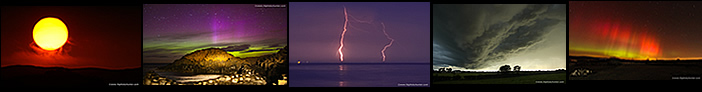
|
In meteorological parlance at this time of year we are technically in early Autumn. Summer is over, or at least to me it has certainly felt that way with the slight change in temperatures, nights drawing in earlier, and the leaves in the trees already changing colour. Normally I consider the inland storm season in the north of the country more or less over with my thoughts turning towards telescopes and auroras with a hint of Halloween in the not so distant future. However this is 2025 where nature does what she wants and this is exactly what happened this day.
You have heard me moaning before on recent reports how the 2025 storm season has been horrendous, my personal worst on record, so mentally I had already moved on in my mind to embrace the change in season and fully accept that Autumn has arrived. The last thing I expected was a proper warm season chase day that actually produced photogenic dramatic storm clouds. I was fully aware of the potential for Thursday September 4th, I had been watching it trending on the GFS for several days prior. High pressure was gone and the classic Atlantic regime was dominating the synoptics with low pressure systems bringing back to back days of mild moisture-rich unstable set-ups, most of which favored southern Ireland or Atlantic coastal areas which is characteristic of the time of year.
On this occasion the GFS was showing 400j/kg of CAPE fairly widespread across Ireland and N. Ireland and LIs between -1 and -2 with temperatures expected in the 17c range. The wind was from the W with models indicating approximately 10 or more knots of surface flow. Cloud tops were -20c however I could find no hint of obvious convergence and both 0-6km and 0-8km shear was absolutely zero. Actually this isn't entirely accurate, there was strong shear moving into W over central Ireland/N. Ireland during the late afternoon and early evening with 40 knots DLS, enough for multicell and even transient supercell traits, however the problem was the strongest instability was moving E quickly and would be over the E coast of NI by late afternoon, so that strong shear and higher CAPE would never overlap, so we were left with unorganized pulse cells, also known as single cells or garden variety thunderstorms. This was disappointing as such scenarios seldom ever produce great storm structure and hence a low chance of photographic potential (but not always!), if there was good convergence then that situation could change in a heart beat however there was none, winds all looked straight lined blowing W to E then after mid afternoon they would even veer somewhat to a NWly. Either way I was game for chasing anyway, after all, how could any chaser pass up the opportunity to see convection inland so late in the twilight of Summer. I was discussing all this with chaser Colleen Webb who was also going to chase so it looked like we would be hitting the road regardless.
On Thursday morning I took a look at the updated models, I was disappointed to see the cold air aloft varying between -15c and -20c, but it definitely looked less than the latter for NI. This really put me off, considering the weak dynamics I speculated the chances of thunder would be low to none at all. It's different if you have strong shear swaying the balance but as mentioned before shear was moving in too late in the day to have any influence on convection in our part of the country. I expressed my concerns to Colleen and really didn't like what I was seeing, I was also concerned if the bases were high then that would affect photo potential also, I was already anticipating yet another disappointing day ahead then later the frustrated drive back home with nothing to show for the chase which seemed to be a hallmark of the majority of the 2025 season. I was tempted just to stay local for this reason then I gave myself a mental slap in the face, I would chase wherever the best parameters were and give it my best, after all, as I always tell people, you never know what you are going to see when you go out.
Where would be the best target area?, the CAPE would be moving into E areas mid afternoon then leave the E coast late afternoon so it wouldn't be hanging around for long. The best combination of solar heating, instability and modeled precip all favored the E. To me the targets would be the Ballymena area, Co. Down, the E coastline and Irish Sea/North Channel areas. Ballymena was appealing as there was model consensus across multiple sources for strong precip cores in that area around 15.00. In fact the AROME showed a hot spot of 500 CAPE over the Ballymena district and the coldest cloud tops would be over the E/NE Antrim areas between Portglenone and Ballymena. This would be our target area and a plan was arranged. I agreed to meet Colleen in her home town of Portglenone at 12 noon then we would relocate to Slemish mountain outside Ballymena for mid afternoon potential.
The morning was bright and sunny and surprisingly warm, convection was sparse and cumulus looked small and warm, I didn't have high hopes. I still was expecting a day of no photogenic skies due to the lack of shear but I forced myself to go, sure why not?, this what I do, it's one of my major passions and what I live for so my dog Rhua and I hit the road leaving Cookstown at 11am. As soon as I entered the carriageway my mood shifted into high spirits, wait a minute, the sky was actually 'talking', you know that moment when your visual information and past instincts suddenly convergence to tell you on a subconscious level that something is going to happen this day, the sky looked good, in fact, it greatly surpassed anything I was expecting to see at this time of day. Congestus towers were growing, they were getting solid and their bases were low, I wasn't expecting that, these were proper surface based towers after all. As I drove N the towers seemed to get taller by the minute, and they were all shifting E slowly trekking towards my target area, it felt like the universe was aligning.
 |
I took the roundabout at Castledawson, onto the Glenshane Road, then the turn off at Knockloughrim, as I passed through the country roads of Gulladuff and Mayogall I spotted nice sunlit convection developing. It was getting beefy and although not tall enough yet for thunder it was encouraging, multiple updraughts ballooned up and the cell began to glaciate, it was developing and my journey E would let me keep pace with it.
 |
Trailing this glaciated cell and located to it's right was a single photogenic updraught with crisp cauliflower edges billowing up rapidly, image taken through the front windscreen. This was looking encouraging and the more I watched the more my adrenaline began to pump and the sharper my senses became. This was outside Portglenone, both cells would be over that very area when I planned to meet Colleen, perhaps it was a good omen. Little did I know it but this one updraught would evolve into one of the most structured storm cells of the entire season for us both. But that was in the future and we were completely unaware of what was to come, my mindset honestly was that I was just happy to see convection at all.
 |
I arrived in Portglenone and met Colleen, as I was parking Colleen already had her drone in the air, she looked transfixed, I knew she had been watching the skies too and was already in the zone, as was I, I was out of the van, barely saying hello, the cells were priority and soon I had my own drone in the air. That white glaciated cell had turned into a big convective shower dropping rain over the edge of town, a red core on radar, behind it new sunlit convection was growing at it's flank and from that convection a new light shower was falling over the landscape. I guided the drone through the air following the River Bann. Then we noticed in the sky behind us a huge updraught plume, where in the heck had that come from?, it was tall, gleaming white in the sunshine, the tops were crisp, it had the lowest darkest base of anything around and it was the tallest tower we had seen all day, this got our attention, we decided we would keep an eye on it, meanwhile it was back to the drone flight.
The state of the majestic River Bann was shocking, it was completely covered from bank to bank and extending as far as the eye could see in blue-green algae, this had been all over the news recently and has become a real concern in recent years, but this year has been the worst anyone had ever seen, perhaps in history, it even made it onto the main ITN English news on television, seeing it here for myself was beyond words. I mentally ignored it and enjoyed flying over the beautiful countryside, then the sun broke out lighting up the fields in vibrant colours, within minutes a beautiful low level rainbow formed directly over the river, nature couldn't have handed me a better composition. I took aerial stills and video sequences, I had to admit it was extremely photogenic.
 |
Same shower falling over the sunlit landscape as the rainbow faded from view like an apparition, it was a very pleasing scene with great contrast and rich colours and good visibility.
 |
What about that updraught behind us? I panned the drone around for a look, the updraught had rapidly developed with a low dark base, from our perspective on the ground the base was partially hidden behind hills and trees but from the air we had a perfect view. This really looked like it was trying to be a storm and that base was well defined, perhaps there was funnel potential. It was moving E so we needed to make a decision on what we were going to do.
 |
I landed the drone happy and content, at least now I had captured something cool today with that rainbow, anything else would just be icing on the cake. We glanced once more behind us for another look at that updraught, phone shot, I really liked the look of this, but what was the plan?, decision making is the most important and crucial aspect of any chase. Being hesitant or simply making one wrong decision can cost you the day, or even worse missing the greatest photo opportunity of the year, or ten years, that isn't an exaggeration, we knew this and weighed our options carefully. It was tempting to stay here, it was a good spot and it would save fuel, there where plenty of red showers on radar in the W heading our way, but I wasn't feeling it, something was telling me to go E to Slemish, the models hinted at it and my instincts were yelling at me to go there. Colleen said if we were going to go then we needed to go now if we wanted to make the mid afternoon best parameters in that area, I asked her how long would the drive be?, she plotted the shortest course on google maps which was 33 minutes, that cell was heading that way anyway, ok let's do it!
 |
We headed E in the direction of Ballymena and by pure good fortune the updraught region was in full view for much of the drive, this was a phone capture through the windscreen showing the updraught we where after, but something caught my eye, why where those towers leaning over so strongly?, there was no vertical wind shear to do that, I didn't understand what was going on but I liked it, every instinct was telling me we needed to stay with this cell and if possible get ahead of it. At times the base was dead ahead, at other times to our half right, I managed to observe it periodically as we drove through the main streets, twisting country roads and while passing small villages, but during that entire time I was shocked to see it rotating. The base had dark tendrils of scud rotating and rising aloft into the base, I was sure it was going to drop a funnel at any moment, I gave the horn a blast to alert Colleen who was ahead of me on the road but she didn't hear, she was focused on getting to our destination. I was tempted to pull over but there where too many buildings in the way, it was still raining at times and I couldn't fly the drone from these congested areas anyway so we kept going.
 |
Another image through the windscreen shot later as we got a closer view of the base outside Ballymena, and it was still rotating, I don't think I've ever observed persistent rotation like this during September before and yet again I was perplexed by the strong tilt of the updraught, also it had a large vault region separating the base from the precip, visual cues only seen on strongly sheared storms. I kept going while occasionally clipping the big precip core when the base got lost behind heavy rain then we would emerge back into clear skies and the base was still rotating.
 |
We entered the back roads of Broughshane and climbed in elevation into the beautiful countryside in that area, many of the roads were flooded over from the rain. Finally we arrived near Slemish and pulled over at the side of the road facing W and got out for a look. By pure random luck we had just managed to get ahead of our target cell, we where actually perfectly positioned to it's E, there was still light rain falling overhead so we had to wait before getting the drones in the air. This is a phone image of the convection approaching, it looked nice, and the dark base was lowering closer to the ground, several dynamic lowerings and scud tags could be seen twisting, the overall impression was of a very lively and agitated base.
 |
I couldn't wait any longer, despite light rain overhead I got the drone in the air and began slowly flying across the field towards the cell, the base of which had organized rapidly and looked like a curved wall of dark cloud. One lowering in particular was spinning faster than the others, we considered it to be a weak funnel cloud but it only lasted a minute then other lowerings took to the stage.
 |
Drone crop into the base, there was a lot going on, too much to try and figure out so we didn't waste time and began recording the scene. I was switching between drone images, drone video, phone images and DSLR shots, swapping between one and the other constantly while trying to observe the situation playing out. We could hear rumbles of distant thunder behind us, radar showed lightning over the NE coast, not really that far from us as the crow flies.
 |
The overhead rain stopped and finally I could relax with the drone and get higher in the sky, Colleen and I looked at each other, structure!, yet another thing I never expected to see this day, I was already thinking this looked like a sheared storm. Big rounded scudy lowering under the base, precip core on L, scud swirling and entire cell slowly heading our way.
 |
I half jokingly said this looked like a scene directly from the Great Plains of the USA. That lowering was bending and tapering towards the ground, the whole base looked like it was exhibiting circular motion internally.
 |
The dark storm clouds over the rain soaked fields of Co. Antrim made for an impressive sight
 |
Above the dark base where the sunlit brilliant white convective tops, at least three bright updraught towers arranged in a stair step fashion from R to L with the central updraught at L centre. The tallest tower extended above the frame of this wide angle image.
 |
The rotation here wasn't violent, it was slow, gentle, but still obvious, and to be honest with you Colleen and I were convinced it was going to drop a big funnel over these fields and farms at any moment, it really looked the part. We were tense with excitement and anticipation while concentrating on the photography.
 |
Full wide angle structure scene, updraught/downdraught separation, rain free base with big lowering, cloud swirling and rising under the base, precip well vented away from the base, tilted updraughts above, I think you know where my thought process was going, I didn't want to say it out loud at the time as the synoptics didn't support it, but yet here it was.
 |
Forward flank downdraught/precip core was now white on radar, a large white core actually edging closer to us. The base seemed to get even darker and there was clearly what looked like striation lines along the base itself. Why this wasn't producing thunder was beyond me, visually it looked like a full on thunderstorm, on radar it looked like a thunderstorm, but I suspected the tops may just not have been cold enough to tilt the scales. That didn't bother me, I'm a structure person, complex and mean storm clouds are what I'm after and now I was getting them on a day when I least expected it, and in early Autumn.
 |
Crop into the base, I will confess Colleen and I were absolutely buzzing at this stage, this was on another level entirely, for Colleen it was the best storm structure of the entire Summer, for me it was the best structure of the Summer from N. Ireland, the only storms which surpassed it would have been the big CAPE Sligo multicells back in July, but that was Ireland not N. Ireland so this was the best storm scene of the year for me in the north of the country hands down.
 |
Big cell getting closer and the base seemed to grow in length and still sported long striation lines, black scud continued to swirl and dance and twist over the lush green fields, the visual scene was quite spectacular.
 |
Deep crop into the base, everything was so still, dead calm, there was no wind at all, it seemed this cell was just creeping towards us at walking pace, perfect really, we didn't need to move and we where standing in warm dry air, we couldn't have asked for better.
 |
The drone battery was getting low and the precip core was getting close, we would soon be getting rained on, so I landed and switched to a new battery and left the drone on the bonnet. I had my power unit with me so I was able to charge drone batteries on the go which was a great feeling.
 |
I took out the phone for a final image, not wide angle but the super wide angle camera with really impressive striation lines, yet again I knew what I was thinking this looked like but I didn't say it, I would find out later Colleen had been thinking the same thing. The scud lowerings seem to loose definition and I assumed the cell was weakening, I turned my back on it for a few minutes to check my gear and the charging batteries, Colleen was busy too sorting things out, when when we turned around again this was what we saw...
 |
My first reaction was wow, actually I used more colourful language than that, what the heck!!!, this looked like a lowering under a supercell thunderstorm from the States, I finally voiced it, Colleen said she was thinking the exact same thing. I almost froze for a moment not knowing what to do, this structure was amazing, I snapped out of it and powered up the drone and took off from the bonnet and over the field. This was rotating at the surface and at mid levels of the structure, the lowering was rotating and that horizontal band of cloud on the L was feeding across from L to R, , the collar above was turning in a semi circle, there was also small scale rotation on the right, the overall structure gave the impression of wrapping. I'm tempted to call this a rotating wall cloud, it was under the updraught base, it was rotating, and it was lowering and tapered to the left towards the precip core, the core edge is visible to the left, either way it was stunning to watch and very photogenic, this is wide angle so it was a big imposing form.
 |
When something this big and dark is rotating close you really do expect a funnel at any moment, still turning/rotating here and that horizontal cloud feature almost looked like a tail cloud but on the wrong side, normally it would be on the right side. From when I first saw the rotation near Portglenone until now this base must have been rotating for between 45 min's and an hour!, phone snap here, then the clouds began to weaken, the swirling eased and the rain hit suddenly and this brought an end to our best storm structure of the year.
We parked at the base of Slemish and waited on the rain to clear, when it did we were treated to a wonderful afternoon with very warm temperatures and blue skies with convection. We knew we had experienced the best of the day and with CAPE drifting away E we could just relax, catch some rays, bath in the early Autumn sunshine and discuss our storm cell experience while buzzing. By late afternoon we decided to call it a day, before we parted Colleen checked radar, there where a few cells to the W with red cores back home, this was surprising yet again, I decided I would keep an eye on them on the way home. The drive back was under blue skies and bright sunshine, we did stop once to watch a high base which was exhibiting rotation, the we went our own way home.
Picture the scene, it's 17.50 local time, I'm driving S along the main Glenshane Rd not far from Castledawson roundabout, in the distance behind a tree a nice cell was lit in the late evening sunshine with crisp convection at it's flank, when I cleared the trees my jaw dropped, there was a spectacular funnel cloud clear in view for all to see! It was located under the base of that convection and hung down and to the right (W) in a horizontal orientation, it was a long slender perfectly formed white rope funnel, extremely well defined with very sharp edges, the rope twisted and undulated along it's length then finished at tapered point. It was lit by full sunshine and was so easy to see despite being many miles away, it was at my 10 o'clock position so I suspected it was either over Lough Neagh or the Toome/Antrim area.
I pulled over onto the hard shoulder and ran out, the funnel had already shrunk, I knew I would have no time to take my DSLR from the bag and attach the 400mm lens, it just wasn't happening, I took out the phone but it didn't have the focal length and resolution I needed, then the funnel was gone. I never got a single image so this was just a visual observation, in truth this was an extremely photogenic event and the stuff dreams are made of, it looked similar to the big white rope funnels in the USA. I was certain images of it would soon be flooding social media, I was still glad to have seen it, it was icing on the cake on top of a great structure day. When I got back home I was shocked to find no one had got an image of it or even seen it, how could it be possible I was the only one, everyone must have been eating their dinners or watching TV, but the roads were full of cars, maybe people weren't looking at the sky, in any event it was an impressive sighting and my first ever funnel observation in September, I reported it to TORRO. What a great way to end a chase day!
So why did we end up seeing a sheared highly structured cell when the charts didn't show that potential?, the answer is I don't know but I suspect one of two scenarios.
1) That strong 30-40 knot DLS shear on the charts moving in during the late afternoon may have arrived much earlier, perhaps the models had been wrong and the synoptics had changed since the 10.45 morning run, this happens all the time and could explain what we saw, such strong shear over a very slack surface flow would generate the structures we observed.
2) Maybe it was entirely the result of the collision between outflow boundaries where downdraughts from two or more precip cores create their own surface convergence resulting in low level rotation which manifested within the updraught base.
But then again what about that evening funnel which wasn't near any outflow?, I suspect the Slemish cell could have been a combination of both these factors, strong shear moving in earlier than expected in conjunction with local convergence. I'm convinced of this as the updraught tower was leaning over for a long time, shear is the only natural mechanism which can do this. That's my theory anyway, the only way to know for sure would be to see a sounding from the Ballymena area around mid afternoon.
In any event what an impressive day which underscores the philosophy that you just never know what you are going to see when you go out. Video containing vlog, drone footage of the rainbow and the Slemish cell. The musical score shifted on me when I saved it so there's no music during the second half but I uploaded another video of just the drone footage with music which you can watch here. Thanks very much for reading.
Martin McKenna